projects
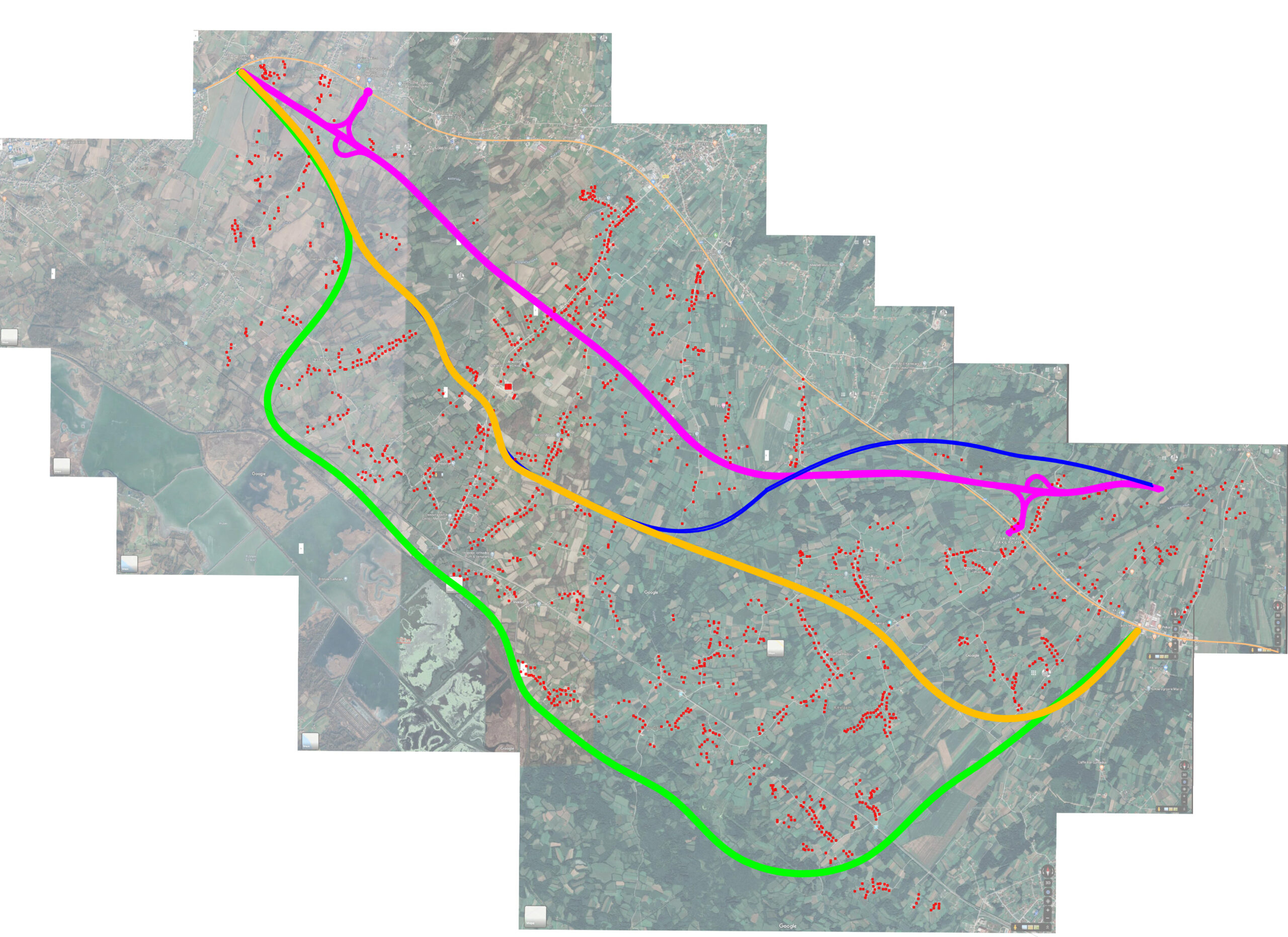
HIGHWAY PRIJEDOR-BANJA LUKA, ALTERNATIVE ROUTES
Date: 01.08.2020
Location: Kozarac, Bosnia & Hercegovina
The Maps were prepared and made by Bešlagić in coordination with the self organised Citizens’ Initiative.
The displayed map represents a "synopsis" of several alternative routes compared to the one offered by the Banja Luka Institute of Civil Engineering (purple line).
Drone footage, field consultations, and drawing of maps were used to suggest alternative routes for the Prijedor-Banja Luka highway that would avoid demolition of buildings and the vivid life of Bosniak and Croatian returnees after the 1990s war in the Kozarac region (Bosnia and Herzegovina).

© Amel Bešlagić 2022